Home Blog

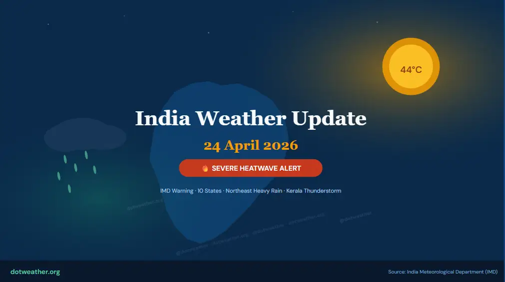
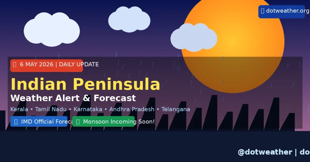
Indian Peninsula Weather Update Today 6 May 2026 โ€“ IMD Alert, Rainfall & Heat Forecast

๐Ÿ“… 6 May 2026  |  dotweather.org  |  IMD Based Forecast

๐ŸŒง Indian Peninsula Weather Update Today โ€”
6 May 2026: Heavy Rain Alerts, Heat Warnings & Monsoon Countdown

Complete IMD-based weather forecast for Kerala, Tamil Nadu, Karnataka, Andhra Pradesh, Telangana & Goa. Stay prepared with today’s 7 accurate, real-time insights.

Indian Peninsula weather update today for 6 May 2026 brings significant activity across South India’s coastal and interior regions. The India Meteorological Department (IMD) has issued multiple alerts ranging from heavy rainfall warnings over Kerala and Tamil Nadu to hot & humid advisories for Coastal Andhra Pradesh. Pre-monsoon convective systems are intensifying, and with the southwest monsoon potentially arriving early this year, the next few weeks are crucial for millions across the peninsula. dotweather.org brings you a complete, city-by-city forecast breakdown for today.

โ˜€๏ธ Today’s Quick Weather Snapshot

๐ŸŒก๏ธ
34โ€“41ยฐC
Peninsula Max Temp
๐ŸŒง๏ธ
Heavy
Kerala & TN Rainfall
๐Ÿ’จ
50โ€“60 km/h
Coastal AP Wind Speed
๐Ÿ’ง
110%+
May Rainfall vs LPA
๐ŸŒŠ
~25 Days
Monsoon ETA (Kerala)
โ˜๏ธ
Pre-Monsoon
Current Phase

๐Ÿšจ IMD Colour-Coded Warnings for 6 May 2026

๐Ÿ”ด
RED ALERT โ€” Take Action Immediately Extremely heavy rainfall (>204.4mm) possible at isolated locations over northern Kerala and coastal sub-divisions. Squalls with winds of 50โ€“60 km/h gusting to 70 km/h along Coastal Andhra Pradesh coast.
๐ŸŸ 
ORANGE ALERT โ€” Be Prepared Very heavy rainfall (115.6โ€“204.4mm) likely over Tamil Nadu, Puducherry, Karaikal, South Interior Karnataka & Coastal Andhra Pradesh on 6 May 2026. Thundersquall with gusts reaching 70 km/h.
๐ŸŸก
YELLOW ALERT โ€” Be Aware Thunderstorms with lightning and gusty winds (40โ€“50 km/h) very likely over Kerala & Mahe, Tamil Nadu, Rayalaseema & South Interior Karnataka. Hot and humid conditions over Coastal Andhra Pradesh.
๐ŸŸข
GREEN (No Warning) Parts of Interior Karnataka and Telangana plateau may see partly cloudy skies with isolated light showers only. Temperatures to remain above normal.
โšก
Thundersquall
Coastal AP โ€” 50โ€“70 km/h
๐ŸŒง
Heavy Rain
Kerala, TN, S.Karnataka
๐ŸŒฉ
Lightning Alert
Rayalaseema, Telangana
๐ŸŒก
Heat & Humidity
Coastal AP โ€” Above Normal
๐Ÿ’จ
Squally Winds
N.Andhra Pradesh Coast
๐ŸŒช
Gusty Winds
Lakshadweep โ€” 30โ€“40 km/h

๐ŸŒด State-by-State Indian Peninsula Weather Today

๐ŸŒด Kerala & Mahe
27โ€“33ยฐC
Today’s Range
๐ŸŒง Heavy Rain
Humidity: 80โ€“92%
๐Ÿ”ด Heavy Rain Warning

Isolated heavy to very heavy rainfall continuing over northern Kerala and Mahe today. Thunderstorms with gusty winds of 40โ€“50 km/h expected. Coastal fishing advisory in effect โ€” fishermen advised not to venture into sea today. Minimum temperatures remain above normal.

๐Ÿ› Tamil Nadu, Puducherry & Karaikal
30โ€“38ยฐC
Today’s Range
๐ŸŒฉ Thunderstorm
Humidity: 65โ€“85%
๐ŸŸ  Orange Alert

Gradual fall in maximum temperatures by 3โ€“5ยฐC expected from Day 3 (6 May). Light to moderate rainfall with partly cloudy skies across most districts. Interior districts like Salem and Namakkal have already recorded significant rainfall in the past 48 hours.

๐ŸŒŠ Coastal Andhra Pradesh & Yanam
34โ€“41ยฐC
Today’s Range
๐Ÿฅต Hot & Humid
Humidity: 75โ€“90%
๐Ÿ”ด Squally Wind Alert

Maximum temperatures appreciably above normal (3.1โ€“5.0ยฐC) over coastal AP today. Thundersqualls with winds reaching 50โ€“60 km/h and gusts to 70 km/h along the coast. Hot and humid weather conditions persist at isolated coastal locations. Fishermen strongly advised not to venture into sea.

๐Ÿ” Karnataka (Coastal & Interior)
28โ€“35ยฐC
Bengaluru: 28โ€“33ยฐC
๐ŸŒฆ Light Drizzle
Humidity: 55โ€“70%
๐ŸŸก Yellow Alert

South Interior Karnataka to see rainfall on 6 May with more intense activity expected during 7โ€“9 May. Bengaluru enjoys pleasant weather with light drizzles and a comfortable maximum of 33ยฐC. Coastal Karnataka may experience thunderstorms with lightning. North Interior Karnataka above-normal temperatures persist.

โšก Telangana & Rayalaseema
33โ€“39ยฐC
Today’s Range
โšก Lightning Risk
Humidity: 50โ€“65%
๐ŸŸก Lightning Advisory

Thunderstorms with lightning and gusty winds (30โ€“40 km/h) likely at isolated places over Telangana and Rayalaseema. Temperatures above normal across the region. Minimum temperatures also remain warmer than usual. Citizens advised to avoid open fields during afternoon thunderstorms.

๐Ÿ– Goa & Konkan Coast
28โ€“34ยฐC
Today’s Range
๐ŸŒค Partly Cloudy
Humidity: 70โ€“82%
๐ŸŸก Elevated Humidity

Konkan coast and Goa see above-normal minimum temperatures (3.1โ€“5.0ยฐC departure). Partly cloudy skies with chance of pre-monsoon showers by late afternoon. Sea conditions rough along the Konkan coast โ€” beach tourism should exercise caution. The monsoon is expected to arrive here by mid-June 2026.

๐Ÿ“Š City-Wise Temperature & Condition Table โ€” 6 May 2026

๐Ÿ™๏ธ City ๐ŸŒก๏ธ Max Temp ๐ŸŒ™ Min Temp โ˜๏ธ Condition โš ๏ธ Alert
Thiruvananthapuram 30ยฐC 24ยฐC Heavy Rain ๐ŸŒง๏ธ Orange
Kochi (Cochin) 31ยฐC 25ยฐC Thunderstorm โ›ˆ๏ธ Orange
Kozhikode (Calicut) 33ยฐC 25ยฐC Heavy Rain ๐ŸŒง๏ธ Red
Chennai 38ยฐC 27ยฐC Hot & Partly Cloudy โ˜๏ธ Yellow
Madurai 40ยฐC 26ยฐC Partly Cloudy ๐ŸŒค๏ธ Yellow
Bengaluru 33ยฐC 22ยฐC Light Drizzle ๐ŸŒฆ๏ธ Yellow
Mysuru 34ยฐC 22ยฐC Partly Cloudy โ›… Yellow
Mangaluru 32ยฐC 24ยฐC Thunderstorm โ›ˆ๏ธ Orange
Hyderabad 38ยฐC 26ยฐC Cloudy, Lightning โšก Yellow
Visakhapatnam 40ยฐC 28ยฐC Hot, Humid, Squally ๐Ÿ’จ Red
Vijayawada 41ยฐC 28ยฐC Hot & Humid ๐Ÿฅต Orange
Puducherry 36ยฐC 26ยฐC Light to Mod. Rain ๐ŸŒง๏ธ Yellow
Panaji (Goa) 33ยฐC 25ยฐC Partly Cloudy ๐ŸŒค๏ธ Yellow

๐ŸŒ Indian Peninsula Weather Update Today โ€” Overview & Analysis

The Indian Peninsula weather update for 6 May 2026 is dominated by intense pre-monsoon convective activity, driven by a persistent trough extending from the cyclonic circulation over North Telangana to the Comorin area across Interior Karnataka, Rayalaseema, and Tamil Nadu. This synoptic setup is fuelling widespread thunderstorms and heavy rainfall across southern India today.

๐ŸŒง Why is it Raining So Much in May 2026?

May is India’s transition month โ€” the brutal dry heat of April gives way to increasingly volatile pre-monsoon convective systems. An upper-air cyclonic circulation persisting over North Telangana and a wind discontinuity line running from there to Cape Comorin is acting as a trigger for organised cloud bands. This year, the IMD has confirmed that May 2026 rainfall is likely to exceed 110% of the Long Period Average (LPA), making this an unusually wet pre-monsoon season for South India.

๐ŸŒก Temperature Departures Across the Indian Peninsula

Maximum temperature departures over Coastal Andhra Pradesh are appreciably above normal by 3.1โ€“5.0ยฐC, making it the hottest region of the peninsula today. Tamil Nadu and Puducherry have also seen maximum temperatures markedly above normal (over 5.1ยฐC) at isolated places in recent days. Bengaluru remains a pleasant outlier at 33ยฐC thanks to its elevation. Minimum temperatures are above normal across almost all coastal sub-divisions, making nights uncomfortably warm for those without cooling.

๐Ÿ’จ Coastal Marine Warning โ€” Indian Ocean & Bay of Bengal

Squally winds with speeds of 45โ€“55 km/h gusting up to 65 km/h are expected along and off the North Andhra Pradesh coast and adjoining Bay of Bengal. Fishermen from Coastal Andhra Pradesh, Odisha coast, and adjoining North AP are strongly advised not to venture into the sea on 6 May 2026. The sea state will be rough to very rough along these coastlines. For real-time marine forecasts, visit the IMD official website or the Mausam App.

โ˜€๏ธ Heat Safety in Andhra Pradesh & Telangana

With temperatures soaring to 41ยฐC in Vijayawada and 40ยฐC in Visakhapatnam, residents of Coastal Andhra Pradesh face both extreme heat AND squally wind conditions today. The combination of high humidity (75โ€“90%) and high temperatures creates a dangerous heat index. Authorities recommend avoiding outdoor activity between 12 PM and 4 PM, drinking at least 3โ€“4 litres of water, and wearing light cotton clothing. For internal links: also read our Heatwave Safety Guide for India.

๐ŸŒŠ Lakshadweep & Island Territories

Lakshadweep islands are seeing thunderstorms with lightning and gusty winds in the 30โ€“40 km/h range. This is consistent with the broader southwest Arabian Sea activity that is beginning to signal early monsoon-like conditions. Sea surface temperatures in the southeastern Arabian Sea are warming up, which is a key precursor to monsoon onset over Kerala.

๐ŸŒŠ Southwest Monsoon 2026 Countdown

โณ Monsoon Arrival Countdown

~25

Days Until Monsoon Onset Over Kerala

IMD forecasts the southwest monsoon to arrive over Kerala around its normal date of June 1, 2026, with some global models hinting at a possible early arrival around May 25. The monsoon is then expected to advance progressively northward through June and July.

92%
of LPA โ€” Juneโ€“Sept
Monsoon Forecast
110%+
of LPA โ€” May
Pre-Monsoon Rainfall
Jun 1
Normal Monsoon
Onset Date โ€” Kerala
Neutral
Current
ENSO Status

๐ŸŒฆ Monsoon 2026 โ€” What to Expect for South India

South Peninsular India โ€” Above-Normal Rainfall Likely

While the IMD’s long-range forecast for the Juneโ€“September 2026 southwest monsoon season projects below-normal rainfall (92% of LPA) for India as a whole, South Peninsular India is one of the exceptions โ€” where normal to above-normal rainfall is likely. This means Kerala, coastal Karnataka, Tamil Nadu, and southern Andhra Pradesh could see good monsoon rains this year even as large parts of central and northwest India may face deficient conditions.

El Niรฑo & IOD Factors

The Monsoon Mission Climate Forecast System (MMCFS) currently shows ENSO-neutral conditions in the Pacific, transitioning from weak La Niรฑa-like conditions. However, El Niรฑo conditions could develop during the peak monsoon season (Julyโ€“September), which may suppress rainfall. On a positive note, a positive Indian Ocean Dipole (IOD) โ€” where the western Indian Ocean is warmer โ€” is expected to develop towards the end of the monsoon season, which typically enhances monsoon performance over South India. For a deeper dive, visit the IMD Monsoon Information Page.

๐Ÿ›ก๏ธ Weather Safety Tips for 6 May 2026

โšก
Lightning Safety Stay indoors during thunderstorms. Avoid open fields, tall trees, and metal structures. Unplug electronics during storms in Telangana and Rayalaseema.
๐ŸŒŠ
No Sea Fishing Fishermen in Coastal AP, Kerala, and Tamil Nadu must NOT venture into sea today due to squally winds and rough seas.
๐Ÿ’ง
Stay Hydrated In heat-affected areas (AP, Telangana), drink 3โ€“4 litres of water. Avoid alcohol and caffeine which dehydrate.
๐Ÿ 
Avoid Peak Heat Stay indoors between 12 PM and 4 PM in Vijayawada, Hyderabad, Visakhapatnam, and Madurai. This is peak heat index period.
๐Ÿ“ฑ
Stay Informed Download the Mausam App by IMD for real-time, location-based weather alerts. Check updates before commuting.
๐Ÿš—
Travel Caution Low visibility during thunderstorms in Kerala and Coastal Karnataka. Drive slowly, maintain distance, and use headlights.

๐ŸŒ Follow dotweather.org for Live Weather Updates

Get real-time Indian Peninsula weather updates, storm warnings, monsoon tracking, and city-wise forecasts on all our platforms. Turn on notifications so you never miss a critical weather alert!

๐Ÿ”— Official Weather Resources & External Links

For the most accurate and up-to-date Indian Peninsula weather updates, always cross-check with official government and meteorological sources:

๐Ÿ“ž IMD Weather Helpline: 011-2434-4599 | ๐Ÿ“ง IMD Enquiries: nhac@imd.gov.in

โš ๏ธ Disclaimer: This weather forecast is prepared by the dotweather.org editorial team based on official bulletins from the India Meteorological Department (IMD), satellite data, and verified meteorological sources. Weather is a dynamic phenomenon โ€” conditions can change rapidly. For real-time and location-specific alerts, always refer to the IMD official website or the Mausam App. dotweather.org is not responsible for decisions made solely based on this forecast. Stay safe, stay informed.

7 Critical Europe weather updates today

0
DotWeather ยท Global Daily Forecast

7 Critical Europe Weather Updates Today โ€” April 28, 2026 Forecast

Your complete Europe weather update April 28 2026 โ€” covering UK, France, Germany, Spain, Italy, Scandinavia, and Eastern Europe with temperatures, rainfall alerts, wind speeds and travel advisories.

๐Ÿ“… April 28, 2026 ๐ŸŒ Europe Region โœ๏ธ DotWeather.org โฑ 5 min read

The Europe weather update April 28 2026 brings a mix of spring conditions across the continent. A low-pressure system over Northwestern Europe continues to drive cloud and rain into the British Isles and parts of France, while Central and Southern Europe enjoy milder, partly sunny conditions. Average temperatures range from 8ยฐC in Scandinavia to 22ยฐC in the Iberian Peninsula. Read on for a full city-by-city Europe weather breakdown for today โ€” sourced from AccuWeather, Met Office, and ECMWF data.

๐ŸŒก
13ยฐC
Avg High โ€“ Continent
๐ŸŒง
40 mm
Monthly Rainfall Avg
๐Ÿ’จ
18 km/h
Average Wind Speed
โ˜
17 days
Rain Days This Month
โ˜€๏ธ
6โ€“9 hrs
Daily Sunshine (South)

๐ŸŒ Europe Weather Overview โ€” April 28, 2026

Today’s Europe weather update for April 28, 2026 shows a continent caught between the tail end of polar influence and the warming advance of spring. A residual Polar Vortex core has shaped April’s weather pattern, keeping the far northwest cooler and wetter than usual, while a high-pressure ridge over Southern and Central Europe continues to fuel comfortable spring warmth.

Overall, Europe in April 2026 is recording highs around 13ยฐC and lows near 5ยฐC on a continental average, with roughly 40.1 mm of precipitation expected across approximately 17 rain days this month. Wind speeds average 18 km/h โ€” breezy but typical for spring.

What’s Driving Today’s Europe Weather?

The primary synoptic feature on April 28 is a low-pressure system anchored over northwestern Europe, feeding cloud and rain into the UK, Ireland, northwestern France, and the Low Countries. Meanwhile, a strengthening anticyclone over the Mediterranean is pushing warm, dry air into Iberia, southern France, and Italy โ€” giving those areas some of their best spring days of the month.

Scandinavia sees lingering cold with temperatures barely reaching 8โ€“11ยฐC, and Newcastle in the UK can expect highs around 11ยฐC with notable rainfall โ€” consistent with the 19-day rainy-month average and 59.5 mm of precipitation that define April in the region.

๐Ÿ—บ Region-by-Region Europe Forecast

๐Ÿ‡ฌ๐Ÿ‡ง United Kingdom

๐ŸŒฆ

Cloudy with outbreaks of rain, especially in the north. London sees highs of 14ยฐC; Scotland remains cool at 9ยฐC. Low-pressure dominates. April averages 19 rainy days in northern England.

๐ŸŒก Max: 14ยฐC ๐ŸŒง Rain: Likely

๐Ÿ‡ฉ๐Ÿ‡ช Germany

โ›…

Partly cloudy with a few showers possible in the north. Bavaria enjoys 15ยฐC highs. Average April temperature sits at 6โ€“15ยฐC with only 4 rainy days this week.

๐ŸŒก Max: 15ยฐC ๐Ÿ’จ Wind: 15 km/h

๐Ÿ‡ซ๐Ÿ‡ท France

๐ŸŒค

Northwest France sees cloud and rain while Paris enjoys highs of 16ยฐC. The south of France basks in sunshine with 19โ€“21ยฐC in Marseille and Nice.

๐ŸŒก Paris: 16ยฐC โ˜€๏ธ South: 21ยฐC

๐Ÿ‡ฎ๐Ÿ‡น Italy

โ˜€๏ธ

Largely sunny and warm across the peninsula. Rome expects 20ยฐC highs, Sicily approaches 24ยฐC. The north sees some Alpine cloud and cooler overnight lows.

๐ŸŒก Rome: 20ยฐC โ˜€๏ธ Sicily: 24ยฐC

๐Ÿ‡ช๐Ÿ‡ธ Spain

โ˜€๏ธ

Warm and sunny conditions dominate the Iberian Peninsula. Madrid reaches 22ยฐC, Barcelona 20ยฐC, and Seville leads at 25ยฐC โ€” best weather in Europe today.

๐ŸŒก Madrid: 22ยฐC ๐ŸŒž Seville: 25ยฐC

๐Ÿ‡ธ๐Ÿ‡ช Scandinavia

๐ŸŒฅ

Cool and overcast. Oslo reaches 9ยฐC, Stockholm 11ยฐC. Some snow is possible at elevation in Norway. Polar air keeps the region firmly below the continental average.

๐ŸŒก Oslo: 9ยฐC โ„๏ธ Snow: Possible

๐Ÿ“Š Europe City Weather Table โ€“ April 28, 2026

City High ยฐC Low ยฐC Conditions Wind km/h Humidity %
๐Ÿ‡ฌ๐Ÿ‡ง London14ยฐC8ยฐCCloudy / Showers2078%
๐Ÿ‡ซ๐Ÿ‡ท Paris16ยฐC9ยฐCPartly Cloudy1670%
๐Ÿ‡ฉ๐Ÿ‡ช Berlin15ยฐC6ยฐCFew Showers1572%
๐Ÿ‡ฎ๐Ÿ‡น Rome20ยฐC12ยฐCSunny1055%
๐Ÿ‡ช๐Ÿ‡ธ Madrid22ยฐC11ยฐCSunny & Warm1245%
๐Ÿ‡ณ๐Ÿ‡ฑ Amsterdam13ยฐC7ยฐCOvercast / Rain2282%
๐Ÿ‡ธ๐Ÿ‡ช Stockholm11ยฐC4ยฐCCloudy1468%
๐Ÿ‡ฌ๐Ÿ‡ท Athens23ยฐC14ยฐCClear & Sunny948%
๐Ÿ‡ต๐Ÿ‡ฑ Warsaw16ยฐC7ยฐCPartly Cloudy1363%
๐Ÿ‡จ๐Ÿ‡ญ Zurich17ยฐC8ยฐCMild / Sunny1158%

โš ๏ธ Europe Weather Alerts โ€” April 28, 2026

๐ŸŒง

Northwestern Europe Rain Alert: A slow-moving low-pressure system will bring persistent rain and gusty winds to Ireland, UK, and the Low Countries throughout April 28. Wind gusts of 40โ€“55 km/h are possible along western coastal areas. Outdoor events may be affected.

โ„๏ธ

High-Altitude Snow Risk: The Scandinavian Highlands and Alpine regions above 1,000 m may see late-season snowfall. Drivers should exercise caution on mountain passes in Norway, Austria, and Switzerland.

For the latest Europe weather alerts, always check your UK Met Office, Mรฉtรฉo-France, or Germany’s DWD for real-time updates.

๐Ÿ“… 3-Day Europe Weather Outlook

April 28 (Today)

Low pressure dominates the northwest. Southern Europe warm and sunny. Continental average high: 13ยฐC.

April 29 (Tomorrow)

The low-pressure system slowly edges northeast. Brief improvement in UK and France. Thunderstorm risk develops over the Balkans and Eastern Europe as warm and cold air masses clash.

April 30 (Wednesday)

High pressure reasserts over Western Europe ahead of the May Day weekend. Temperatures rise across France, UK, and Germany by 2โ€“3ยฐC. The Mediterranean remains clear and warm, with Spain and Italy continuing to lead on sunshine hours.

Follow dotweather.org for the updated Europe weather forecast each morning at 06:00 UTC. For long-range ECMWF model data, visit ECMWF.int.

๐Ÿ’ก Travel & Outdoor Tips for Europe Today

๐Ÿงฅ
Pack Layers Spring temperatures vary 10ยฐC between morning and afternoon. A light jacket is essential everywhere north of the Alps.
โ˜‚๏ธ
Carry Umbrella (UK/NL) Northwestern Europe has active showers today. Keep a compact umbrella or rain jacket if travelling in the UK, Ireland, or Netherlands.
๐Ÿ•ถ
Sunscreen for South Spain, southern Italy, and Greece have 8โ€“9 hours of sunshine. UV index is elevated โ€” apply SPF 30 or higher.
๐Ÿš—
Mountain Driving Alert Snow chains may be required above 1,000 m in the Alps and Scandinavian highlands. Check local road advisories.

๐Ÿ“ฒ Follow DotWeather for daily global forecasts

Tags: Europe weather update April 28 2026 UK weather today Germany forecast France weather Italy spring Spain weather Scandinavia cold dotweather dotweather.org
ยฉ 2026 DotWeather.org ยท Published: April 28, 2026 ยท dotweather.org/europe-weather

India Weather Update April 24 2026: Severe Heatwave Alert โ€” 44ยฐC Forecast Across 10 States, Heavy Rain in Northeast

India weather update April 24 2026 โ€” The India Meteorological Department (IMD) has issued a multi-state severe heatwave warning as temperatures surge to 44ยฐC across Delhi, Uttar Pradesh, Rajasthan, and Madhya Pradesh. Meanwhile, Northeast India braces for heavy thunderstorms, and South India sees hot & humid conditions with scattered rainfall. Here is your complete state-wise forecast for today.

1. Today’s India Weather Summary โ€” April 24 2026

The India weather update for April 24 2026 paints a tale of two extremes: a relentless, record-breaking heatwave scorching the northern, central, and eastern plains, while pre-monsoon thunderstorms lash the Northeast and coastal South. The IMD has placed 10 states under active heatwave alerts today, with temperatures projected to run 4โ€“5ยฐC above seasonal averages across multiple regions.

According to the IMD’s all-India bulletin, maximum temperatures have been hovering between 38ยฐC and 44ยฐC across most plains, with the highest temperature recorded recently at Banda, Uttar Pradesh โ€” 44.4ยฐC. Dry westerly winds are the primary driver, preventing any overnight relief in affected states.

2. North India Heatwave Alert: Delhi, UP, Punjab, Haryana, Rajasthan

Delhi & NCR โ€” India Weather Update April 24 2026

Delhi is under a Heatwave Alert today with maximum temperatures expected to breach 43ยฐCโ€“44ยฐC. Warm night conditions will prevail through April 26, bringing no respite even after sunset. Residents are strongly advised to stay indoors between 12 PM and 4 PM and keep hydrated.

Yellow Alerts remain active for Punjab districts including Ludhiana, Sangrur, Fatehgarh Sahib, and Patiala through April 24. Chandigarh and surrounding areas will also see significantly elevated daytime temperatures.

Uttar Pradesh โ€” Severe Heatwave Conditions

Both eastern and western Uttar Pradesh are facing severe heatwave conditions with mercury levels touching 44ยฐC, valid through April 26. This is one of the most dangerous heat periods in the region this pre-summer season. Heat stroke risk is high for outdoor workers and vulnerable populations.

Rajasthan โ€” High Alert

Rajasthan is under a high-alert situation valid from April 23 through April 29, particularly in northern and western zones. Temperatures are expected to peak between 43ยฐC and 44ยฐC across Jodhpur, Bikaner, Barmer, and Jaisalmer.

3. Central India: Madhya Pradesh, Chhattisgarh, Vidarbha

A persistent heatwave grips Madhya Pradesh through April 26, with temperatures between 42ยฐC and 44ยฐC. Chhattisgarh and Vidarbha (Maharashtra) face severe heatwave conditions from April 24 through 27. Vidarbha in particular is under an Extreme Heat Warning with temperatures likely to exceed 44ยฐC. Thunderstorm activity with gusty winds (40โ€“50 km/h) is also possible over some pockets of Madhya Pradesh and Vidarbha.

4. East India: Bihar, Jharkhand, West Bengal, Odisha

East India faces a dual threat on April 24 2026. Bihar and Gangetic West Bengal are under active heatwave conditions, while the Sub-Himalayan districts of West Bengal and Sikkim are bracing for heavy rainfall, lightning, and thundersqualls. Bihar is set for thundersqualls with wind speeds reaching 50โ€“60 km/h gusting to 70 km/h on April 25 and 26.

Odisha and Jharkhand face hot & humid conditions and scattered thunderstorms with gusty winds. Hailstorm activity is expected over Jharkhand on April 26 and 27. Fishermen along the North Odisha and West Bengal coasts should exercise extreme caution due to rough sea warnings.

5. Northeast India: Heavy Rain โ€” Assam, Meghalaya, Arunachal Pradesh

Assam & Meghalaya โ€” Intensifying Pre-Monsoon Activity

Northeast India sees a sharp intensification in pre-monsoon weather activity from April 24. After a brief lull on April 23, widespread thunderstorms and heavy rain are returning to Assam, Meghalaya, and Arunachal Pradesh with renewed intensity. Key locations at risk include Guwahati, Shillong, Tura, Cherrapunji, Kokrajhar, Barpeta, Nalbari, Dhubri, and Goalpara.

Upper Assam and Arunachal Pradesh will bear the heaviest rainfall. Thunderstorms will be most fierce during evening and night hours. Residents in hilly areas of Meghalaya must stay alert for landslide risks. Heavy rainfall may lead to waterlogging, travel disruptions, and crop damage.

Nagaland, Manipur, Mizoram & Tripura

Fairly widespread to widespread light-to-moderate rainfall with thunderstorm and lightning is likely through April 27. Residents are advised to avoid unnecessary travel and stay updated with official IMD advisories.

6. South India: Kerala, Karnataka, Tamil Nadu, Andhra Pradesh, Telangana

Kerala โ€” Heat & Thunderstorms

Kerala continues to see isolated heatwave conditions, particularly in Palakkad (up to 40ยฐC), along with thundershowers at one or two places daily through April 27. Hot & humid weather warnings remain in effect for coastal Kerala. Pre-monsoon rainfall activity is picking up, with above-normal cumulative rainfall expected in northern Kerala during the coming week.

Karnataka, Andhra Pradesh & Telangana

Coastal Karnataka, Interior Karnataka, and Telangana can expect light-to-moderate rainfall with thunderstorm and gusty winds (30โ€“50 km/h) through April 26. Tamil Nadu and Puducherry face hot & humid weather along the coast with possible lightning activity. Coastal Andhra Pradesh should prepare for similar conditions through April 25.

7. West India: Gujarat, Maharashtra, Konkan & Goa

Maharashtra’s Vidarbha region remains under the most dangerous heat warning in the country, with temperatures exceeding 44ยฐC. Coastal Gujarat will see hot & humid conditions on April 24 and 25 with temperatures rising 2โ€“3ยฐC above seasonal averages. Konkan and Goa experience hot & humid weather with warm nights, and isolated thunderstorm activity is possible through April 25. No Arabian Sea cyclone warning is currently in effect.

8. Western Himalayas: J&K, Himachal Pradesh, Uttarakhand

A Western Disturbance is currently persisting as an upper-air cyclonic circulation over Jammu & Kashmir. Under its influence, Himachal Pradesh will see isolated rainfall on April 24 and 25, while Uttarakhand can expect light rain and possibly light snow at higher elevations on April 25 and 26. Residents in Shimla, Manali, Dehradun, and high-altitude passes should exercise caution on mountain roads.

9. State-wise Temperature Table โ€” April 24 2026

State / RegionExpected Max (ยฐC)Alert LevelCondition
Delhi & NCR42โ€“44ยฐCHeatwave AlertDry, very hot, warm nights
Uttar Pradesh (E+W)43โ€“44ยฐCSevere HeatwaveExtreme heat, dry westerlies
Rajasthan43โ€“44ยฐCHigh AlertHot, dry, Loo winds
Madhya Pradesh42โ€“44ยฐCHeatwavePersistent heat through Apr 26
Vidarbha (Maharashtra)>44ยฐCExtreme HeatMost dangerous heat zone
Bihar41โ€“43ยฐCHeatwaveHeatwave + thundersqualls Apr 25
Jharkhand40โ€“42ยฐCAlertThunderstorms, hailstorm risk Apr 26
West Bengal (Gangetic)40โ€“42ยฐCHot & HumidHeatwave + heavy rain (sub-Himalayan)
Odisha40โ€“42ยฐCSevere HeatwaveHot, humid coast; rough sea warning
Chhattisgarh42โ€“44ยฐCSevere HeatwaveThrough Apr 27
Punjab / Haryana40โ€“43ยฐCYellow AlertHot, warm nights in Delhi belt
Assam / Meghalaya30โ€“34ยฐCHeavy RainThunderstorms, evening squalls
Arunachal Pradesh28โ€“32ยฐCHeavy RainWidespread rainfall
Kerala38โ€“40ยฐCHot & HumidPalakkad hottest; scattered showers
Tamil Nadu (Coast)36โ€“39ยฐCHot & HumidLightning; coastal heat
Karnataka36โ€“40ยฐCThunderstormsLight rain, gusty winds
Andhra Pradesh (Coast)37โ€“40ยฐCHot & HumidThunderstorms through Apr 25
Gujarat40โ€“43ยฐCHot & HumidTemperatures rising 2โ€“3ยฐC
Himachal Pradesh22โ€“28ยฐCLight RainWestern Disturbance; Apr 24โ€“25
Uttarakhand20โ€“26ยฐCRain & SnowHigh-altitude light snow Apr 25โ€“26

10. Heatwave Safety Tips โ€” IMD Advisory for April 24 2026

๐Ÿ›ก Stay Safe This Heatwave โ€” Official IMD Guidelines

  • Avoid stepping outdoors between 12 noon and 4 PM โ€” this is peak heat danger time.
  • Drink water every 30 minutes even if you are not thirsty. Try ORS, coconut water, buttermilk, or lemon water.
  • Wear loose, light-coloured cotton clothing and use a wet cloth or hat to cover your head.
  • Never leave children, elderly persons, or pets inside parked vehicles.
  • If you feel dizzy, nauseated, or extremely fatigued โ€” seek immediate medical attention. These are early signs of heat stroke.
  • Farmers should irrigate standing crops (rice, maize, pulses) lightly and frequently to reduce heat stress during flowering.
  • Fishermen along Odisha and West Bengal coasts โ€” do NOT venture into the sea on April 26โ€“27 due to rough weather.
  • In Northeast India: stay indoors during evening thunderstorms and do not shelter under trees during lightning.

Hello world!

1

Welcome to WordPress. This is your first post. Edit or delete it, then start writing!